A level crossing could soon be widened to provide a new pedestrian link after 145 homes were approved nearby.
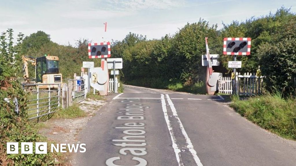
Network Rail plans to reroute a public right of way over Cathole Bridge Road level crossing near Crewkerne, Somerset.
The change would include removing an unsignalised pedestrian route between the level crossing and Crewkerne tunnel, which underwent emergency repairs following a landslip in 2023.
It comes after the Planning Inspectorate granted an appeal by Tilia Homes to construct 145 homes at the nearby Maple Grove site on Lang Road.
According to the Local Democracy Reporting Service, Network Rail applied to Somerset Council for the change in July and are now staging a drop-in event to discuss their rationale on 28 January at the Henhayes Centre.
The crossing provides safe access between Crewkerne and Misterton, with the route running over the London Waterloo to Exeter St. David’s line.
One train runs each way per hour and is run by newly-nationalised South Western Railway.
The existing right of way runs south of Cathole Bridge Road, near to the Lang Road junction, before crossing the railway line.
The route then continues south until it joins a local track, before rejoining Cathole Bridge Road to the east.
If Network Rail’s diversionary order is approved, the footpath will officially run along Cathole Bridge Road to the end of the track.
Cathole Bridge Road has no pavements, high hedges and regularly serves as a rat run for people seeking to reach Crewkerne railway station without navigating the one-system in the town centre.
Somerset Council has not indicated how soon it could make a ruling on Network Rail’s application.
